


Bloom 22 Voting District, Cook County, Illinois
About
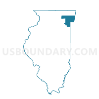
Outline

Summary
| Unique Area Identifier | 568740 |
| Name | Bloom 22 Voting District |
| County | Cook County |
| State | Illinois |
| Area (square miles) | 0.22 |
| Land Area (square miles) | 0.22 |
| Water Area (square miles) | 0.00 |
| % of Land Area | 100.00 |
| % of Water Area | 0.00 |
| Latitude of the Internal Point | 41.54185280 |
| Longtitude of the Internal Point | -87.67206050 |
Maps


Graphs
Select a template below for downloading or customizing gragh for Bloom 22 Voting District, Cook County, Illinois


Neighbors
Neighoring Voting District (by Name) Neighboring Voting District on the Map
- Bloom 1 Voting District, Cook County, IL
- Bloom 20 Voting District, Cook County, IL
- Bloom 42 Voting District, Cook County, IL
- Bloom 50 Voting District, Cook County, IL
- Bloom 58 Voting District, Cook County, IL
- Rich 33 Voting District, Cook County, IL
- Rich 35 Voting District, Cook County, IL
Top 10 Neighboring County Subdivision (by Population) Neighboring County Subdivision on the Map
Top 10 Neighboring Place (by Population) Neighboring Place on the Map
Top 10 Neighboring Elementary School District (by Population) Neighboring Elementary School District on the Map
Top 10 Neighboring Secondary School District (by Population) Neighboring Secondary School District on the Map
- Rich Township High School District 227, IL (69,376)
- Homewood-Flossmoor Community High School District 233, IL (38,253)
Top 10 Neighboring State Legislative District Lower Chamber (by Population) Neighboring State Legislative District Lower Chamber on the Map
- State House District 38, IL (111,279)
- State House District 80, IL (105,281)
- State House District 30, IL (98,066)
Top 10 Neighboring State Legislative District Upper Chamber (by Population) Neighboring State Legislative District Upper Chamber on the Map
- State Senate District 19, IL (222,018)
- State Senate District 40, IL (220,404)
- State Senate District 15, IL (194,460)
Top 10 Neighboring 111th Congressional District (by Population) Neighboring 111th Congressional District on the Map
Top 10 Neighboring Census Tract (by Population) Neighboring Census Tract on the Map
- Census Tract 8298, Cook County, IL (6,820)
- Census Tract 8288.01, Cook County, IL (4,969)
- Census Tract 8286.01, Cook County, IL (4,187)
- Census Tract 8293.01, Cook County, IL (3,982)
- Census Tract 8300.05, Cook County, IL (3,957)